Saturday, May 14, 2011

Blog Post No. 2011-8: North Station...

...now more than just a hallway.

Photo 1: Looking eastward along the row of doorways to the tracks.

Photo 2: Looking from the track doorways toward the entrance to TD Garden.

Photo 3: One of the two train boards.

Photo 4: The eastern end of the concourse.

Location: North Station (Boston), Causeway Street below the TD Garden.

Year of Urban Fabric Restoration: 2007.

The Story: Truly, when we first moved to the Boston area in 1997, North Station had been reduced to just that: a hallway below what was then the Fleet Center. A fairly wide hallway, but a hallway nonetheless. It was a very sad state of affairs considering the rich history of railroad terminals along Causeway Street, at one time serving the multiple lines of four different carriers: the Boston & Maine, Eastern, Boston & Lowell, and Fitchburg railroads. Our friendly rail fanatics who wrote the entry for North Station over at Wikipedia report that the multiple terminals were unified in 1893 with North Union Station (old postcard view here). The old station building lasted all of 35 years before it was torn down to make way for the combined Boston Garden/North Station in 1928.

Photo 5: The old North Station/Boston Garden in 1988. (Credit: MBTA)

As briefly touched upon in Blog Post No. 2011-6, that complex made way for the new building in the mid-1990s that resulted in the hallway treatment for the station and the parking lot out front.

It took the better part of the next decade -- and the reintroduction of intercity passenger rail service with Amtrak's Downeaster to Portland, Maine -- for the powers that be to take pity on the region's north-side railroad passengers and make the savvy improvement that produced what is now known as the Red Auerbach Concourse. In much the same way the Red Sox were painstakingly finding space within the footprint of Fenway Park for improved vastly improved fan concourses, the MBTA and Delaware North (TD Garden's owners) didn't expand the building to create the new space. Instead, they took about 80 feet of unused track and platform area and filled it in with a pretty straightforward concourse complete with expanded concessions (including the obligatory station area watering hole) and not one but two train boards. The Boston Globe published a very helpful diagram at the time the improvement was announced in 2006:

Figure from the Boston Globe in 2006, at the time the expansion was announced.


The expansion project was completed in 2007 and the result is something that looks and feels like a train station, not a hallway. Even so, until the front door on Causeway Street is finally built, North Station will continue to play second fiddle to South Station from an urban fabric standpoint somewhat like present-day Pennsylvania Station suffers in comparison to Grand Central Terminal in New York.

Monday, April 18, 2011

Blog Post No. 2011-7: The last major gap in the Washington Street frontage in Roslindale Square...

...is filled in...

1 - Looking south along Wasington Street.

2 - Same view, landscape orientation.

3 - Along the north side of the building,
access to off-street parking in the rear.

4 - View along the back facade.

5 - The Washington Street facade.

6 - View of the Washington Street facade showing the library next door.

...and an architectural black box is opened to the general public for the first time ever.

Interior of the former Trolley Power Substation.

Location: 4244 Washington Street, Roslindale, MA.

Year of urban fabric restoration: 2011.

Prior fabric view: Click here to see how this site looked before.

The story: On this day, Patriots' Day 2011, we return to Roslindale Square to see a major tear repaired and a street wall anchored. The specific location this time is 4244 Washington Street, in the block between Cummins Highway and Corinth/Poplar streets. Since your faithful correspondent moved to Roslindale in 2000, this particular address had been home to a dilapidated, underused, and, most recently, completely abandoned filling station and garage/car storage. Even if actively occupied and operated, a gas station use in the standard configuration (pumps out front, building in the middle of the site, two curb-cuts) was wrong for this location. This is a location of great importance that sees a good deal of foot traffic throughout the day. It was in desperate need of a strong, street-facing and -filling building to provide a real sense of enclosure to Adams Park. And in this building, we clearly have it.

One might argue that the massing is a bit boxy and the architecture could be a bit more interesting. But I would urge any such critic to appreciate what this building replaces and the still-constrained economic times we are experiencing. Indeed, this building's development was only made possible by the Social Security Administration's decision to move out of its current location on the same street, just to the north of Cummins Highway, and take a long-term lease at this location. I have not seen or heard anything definitive on users for the balance of the space in the building, including the ground floor storefronts. But for the new CVS further up Washington and prior battles over chain drug stores in the square, I might be tempted to think this made a perfect location for a new CVS or Walgreens. The floorplate would be about the size they seem to require for urban locations. However it pans out, we'll have to see what comes of this new retail space and how it fits into the square's broad mix of going concerns. And we'll also have to see how the finish details look at the ground level. You might note that I took the photos this time well in advance of completion of the building. Though this is not typically the RTUF pattern, this building has been so long-awaited an improvement that, spurred on by the slowly advancing spring weather, I couldn't help myself.

The photos of the new building were taken on the same day as the photo of the interior of the former trolley power substation at the corner of Cummins Highway and Washington Street. I am afraid that my photo is pretty poor and doesn't come close to doing the space justice. Victoria Groves, over at Wicked Local, has a much better photo and a nice write-up of the tour event, which had to be the first time the general public has ever been invited into the space since it was built -- until the late 1960s, it was a working substation owned by the city's transit operators powering trolley lines in southwest Boston, and since then it has been vacant and shuttered. There have been a couple different recent false starts on redevelopment -- the MBTA put the space out to bid early in the 2000s and ended up in a dispute with their selected designee and the BRA's RFP process two years ago yielded proposals that it viewed as non-starters. For what it's worth, we here at RTUF think the minimal-improvements-necessary-to-make-it-useable-event-space approach is the only one that has legs at the moment. The interim designee team of Historic Boston, Inc., and Roslindale Village Main Streets could form an entity to lease the space on a relatively short term basis (say, 3 years, and assuming a cooperative BRA that allows the lease on a nominal basis) and that entity could seek low-cost, even volunteer assistance for the required first round of improvements and then rent it out for events of all kinds. There is tremendous upside potential here. But the key is to get the space back into some kind of productive, community-based use along the lines of what good friend Mike Lydon (as served up by Russ Preston over at Life + Urbanism) calls "Tactical Urbanism."

RTUF Sketch of the Restored Urban Fabric: The new building quite clearly fills this site's frontage far better than the former gas/service station building that was set back from the street, had two very wide curb-cuts and was a general drag on the vitality of this busy block.

Sunday, April 3, 2011

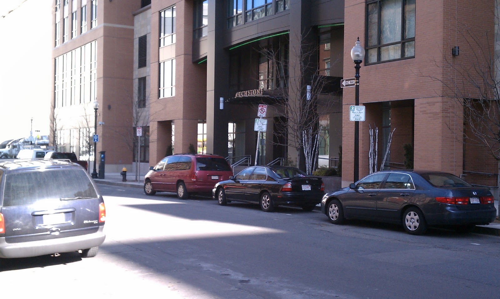
Blog Post No. 2011-6: Archstone Avenir starts the ball rolling on Causeway Street...

...and we have hope for more to come

1 - Information on the now-departed elevated Green Line.

Photo 2 - Looking down Haverhill Street, back toward
downtown (with Custom House Tower in background).

Photo 3 - Looking up Haverhill Street toward TD Garden.
Photo 4 - From Valenti Way, looking across the corner at Canal Street.
Photo 5 - Looking up Canal Street (Avenir on the right).

Photo 6 - Looking from Canal Street down Valenti Way.
Photo 7 - Up close and along the Canal Street facade.
Photo 8 - Main residential entrance on Canal Street.
Photo 9 - Looking east down Causeway Street toward the North End.
Photo 10 - Looking across Causeway Street to the parking lot and TD Garden.
Photo 11 - CVS/Pharmacy to be first occupant of ground floor retail space.
Photo 12 - Looking down Haverhill Street with the next development parcel across the street.

Location: 89 Canal Street, Boston, MA.

Year of Urban Fabric Restoration: 2009.

The Story: So, here we are on Causeway Street, at the top of the Bulfinch Triangle, the area between the West End and the North End of Boston that once comprised the tidal Mill Pond and was filled in the early 19th century according to a plan developed by Charles Bulfinch. This new residential/retail building, developed by Trinity Financial (of Carruth and Washington-Beech fame, see Blog Post Nos. 2010-20 and 2009-10) and now owned and operated by Archstone-Smith, is the first of a series of mixed-use buildings that will fill in the gap just north of the Greenway and create a strong street wall on the south side of Causeway Street: Simpson Housing will be developing Parcel 1 (directly across Haverhill Street and appearing likely to start construction this spring/summer) and Trinity Financial (there they are again) has just recently been designated as the developer to move forward with a long-stalled project on Parcels 2A/2B (to the south of Parcel 1).

Once again this is a massive improvement from the old elevated Central Artery that was bulldozed through the heart of downtown in the 1950s and was finally submerged over the course of the last decade through the Central Artery/Third Tunnel (widely dubbed the Big Dig), not to mention the submerging of the old elevated portion of the Green Line that went on around the same time (more on that below). Avenir's retail has been relatively slow to fill up -- the CVS/Pharmacy shown in Photo 11 is the first of the ground floor retail spaces to be occupied almost 2 years after the building saw its first residential tenants -- but that has had more to do with the overall economy than the design of the building or its location. As the recovery takes hold in earnest and more residents arrive with the foregoing two buildings as well as the redevelopment of Lovejoy Wharf to the northeast, the ground floor space should eventually be occupied and active street frontages established. It will still take some time, but it will come.

Now, to return to the Green Line: This north-south corridor is essentially where the Green Line used to emerge from the downtown tunnel that starts west of Kenmore Square. After Haymarket Station, the trolley rose out of the ground heading north, turned sharply at Causeway Street, and then bent again around what is now the O'Neill Federal Buidling and crossed the Charles River near the Museum of Science. That same basic routing has been maintained, but it is now entirely underground until emerging just before Science Park Station. Avenir sits on top of the reconfigured North Station platforms of the Green and Orange lines that resulted. The result is a sun-strewn Causeway Street after nearly a century of living in the shadows of the elevated train structure and the Central Artery itself.

Of course, the other relatively recent makeover that occurred here was in the demolition of the old North Station/Boston Garden, which fronted directly on Causeway Street, and its replacement with what is now named the "TD Garden" (having been initially known as the Fleet Center), which sits behind a surface parking lot. Having been in the old Boston Garden myself a few times, I will attest that it was a cramped and highly idiosyncratic arena with many partial and fully blocked views because of its supporting columns. That said, if you had a seat with a good sight line, you had much more than that: you had a phenomenal, up-close-on-the-action view of the game. I mean, you were on top of the players and the action like no place else. The new building is decent, but the character of the old place was essentially irreplaceable. Now, if only that parking lot that sits between the new garden and Causeway Street could be filled in with an appropriate front door for the arena and the train station below...

Sketch of the Restored Urban Fabric:


Thursday, March 17, 2011

Blog Post No. 2011-5: The Circus Is Back in Town...

...and Government Center finally gets the right kind of measured treatment

The Big Apple Circus folks were back in full force today, setting up and getting ready to put
on the show at City Hall Plaza.

Faithful readers may recall that this humble little weblog posted about City Hall Plaza last year here, pointing how well the Big Apple Circus fit the place and suggesting it might be a good model for rotating temporary uses in lieu of the big splash approach to fixing what ails our own version of Siena's central piazza. So, as the photo suggests, the circus is now back in town, and we have news today of what I view as a solid set of incremental steps and proposals to be rolled out in a manageable succession that, when done, should result in a much better seat for our municipal government. In "After many false starts, a new City Hall Plaza plan," the Boston Globe's Casey Ross lays out the progression of steps that the City has managed to stitch together. Take a look and judge for yourself if the City is on the right track here. For my money, the highlights are smoothing the transition from Cambridge Street to Congress Street, replacing the truly hideous bunker that is the Government Center T station headhouse and thinking intelligently about how to break up the superblock. Whether they stick with all of the tree planting they're showing is anyone's guess, but the slide show is well worth looking at, if only for the incredible range of images and thinking about a single place over the last half century. Fasincating.

Bottom line: I think we can all support the notion that if Kairos Shen does half as well with City Hall Plaza as Janet Marie Smith did with Fenway Park -- that is to, incremental changes year on year that result in a much improved ensemble almost without anyone noticing it -- we'll be truly thankful.

Friday, March 11, 2011

Blog Post No. 2011-4: CNU NEW ENGLAND, INC. NOTICE and AGENDA for 2011 Members Meeting

Notice of Meeting:

2011 ANNUAL MEETING OF THE MEMBERS OF CNU NEW ENGLAND

Pursuant to Article III, Section 7 of the By-Laws of CNU New England, all Members in good standing of CNU New England are hereby given notice that the 2011 Annual Meeting of the Members of CNU New England shall take place as follows:

DATE: March 17, 2011
TIME: 5:30 pm
LOCATION: Bar, 254 Crown Street, New Haven, CT


Draft Agenda:

Agenda for 2011 Annual Meeting of Members


I. Attendance and Quorum Check
II. Call to Order
III. Presentation of Annual Financial Report
IV. Annual Report for 2010 and Outlook for 2011
V. Election of Directors and Officers

NOTE: The Board of Directors is comprised of twenty-seven (27) individual Members, each serving staggered three (3)-year terms (except for the Student Member, who serves for a one (1)-year term) including those Directors holding the offices of President, Vice President, Treasurer and Clerk as well as twenty-three (23) At-Large Directors, drawn from the membership generally, but including at least one (1) member from each of the region’s states.
The Executive Committee of the Board of Directors nominates the following slate of candidates for the open positions of members of the Board of Directors and Officers of CNU/NE:

Proposed Slate for Open Board PositionsNo./Name/Term Length (expires in)


1 Dean Amadon* 2 years (2013)
2 Robin Bergstrom* 3 years (2014)
3 Rick Chellman* 2 years (2013)
4 Bill Dennis* 3 years (2014)
5 Beth Della Valle* 2 years (2013)
6 David Dixon* 3 years (2014)
7 Jonathan Ford* 2 years (2013)
8 Norman Garrick 3 years (2014)
9 Lucy Gibson* 3 years (2014)
10 Philip Langdon 2 years (2013)
11 Matt Lawlor* 2 years (2013)
12 Ben Morton* 3 years (2014)
13 Patrick Pinnell* 3 years (2014)
14 Donald Powers* 2 years (2013)
15 Marian Pressley* 3 years (2014)
16 Keith Rand 1 year (2012) (Student Director)
17 Kathryn Schulte* 3 years (2014)
18 Stephanie Zurek* 2 years (2013)
* - Continuing member.

Proposed Slate of Officers

Position/Name


President/Russell Preston
Vice President/Stephanie Zurek
Treasurer/Matt Lawlor
Clerk/Robin Bergstrom


Officers hold their positions for one (1) year, until the next Annual Meeting of the Members.

VI. Other Business
VII. Adjournment

Monday, February 28, 2011

Blog Post No. 2011-3: Four Green Fields at One Boston Place...

Because really incremental improvements are sometimes worth looking at if the baseline was really bad.

(1)
(2)


(3)


(4)

(5)


(6)


Photos: Taken with my new Droid Incredible by HTC (yes, I know it's already a couple of steps behind the newest-latest, but that's how it's done here at RTUF) smart phone, so the pix aren't quite as nice as they could be: (1) Looking at the front of the public house from the sidewalk on Washington Street; (2) A bit longer view, from across Washington Street; (3) The edge of the pub and the main building entrance for One Boston Place (aka, 201 Washington Street); (4) Looking toward the end of Washington Street, with the Ames Building and the Washington Place pedestrian mall and the Old State House; (5) Main entrance from across Washington Street; and (6) A view up Court Street with the Court Street entrance and the Boston School Committee building beyond.

Location: One Boston Place (201 Washington Street), Boston, MA.

Year of Urban Fabric Restoration: 2011.

The Story: So, in the interest of full disclosure, this is where your faithful RTUF correspondent works (not in the pub, but in the building above). This building -- which I refer to as the "big black building with the black box on top across the street from the Old State House" whenever asked -- had to, in its original configuration, have been one of the most uninviting buildings anywhere in Boston. Designed by Pietro Brulleschi and developed by Cabot Cabot & Forbes as the new headquarters for The Boston Safe Deposit and Trust Company in 1970, the old street level exterior resembled nothing so much as a crypt or a bunker. It was one forbidding building, let me tell you, and it sent out the message that no one need come near it who didn't have some serious business to transact inside. The buidling entrances on both Washington and Court streets were set within low-slung, horizontal brown granite blocks with no canopies and almost no way to see inside the building and afterthought planters and benches on the residual space between the building and street on both sides. Bad, bad, bad, and especially so considering that the Old State House across Washington Street has a rich history as the oldest public building in Boston, the seat of the old colonial government, the new state's seat of government until Bulfinch's New State House was built on Beacon  Hill in the early 19th century, and the site of the Boston Massacre in March of 1771.

Perhaps the acquisition of The Boston Company by Mellon and Mellon's merger with BNY in the 1990s and early 2000s led to a renewed look at the buidling and its potential to draw tenants on its own as the headquarters footprint was reduced. Whatever the cause, in the early 2000s, the building's owners started a program of making the ground level more transparent and comfortable (hence the glass walls and canopy) and improving the public space between the building and the adjoining streets. The final step in that rethinking and reimagining is the restaurant space simply by putting windows where formerly there were blank walls and seeding a patio where none was really considered before. This part of the plan has finally borne fruit in the opening of Four Green Fields, an Irish pub and restaurant, just this month. So far, the pub is drwaing crowds and come spring and summer after this classic New England winter, it seems reasonable to expect patio seating in what is a shady spot given its northeast exposure. With the restoration of the Ames Buidling at the end of Washington Street and the installation of a decidedly upscale patio area there, it is fair to say that this end of Washington Street hasn't had so much to recommend it to the casual visitor in a long, long time.

RTUF Sketch of the Restored Urban Fabric: The hatched area here is the street level extension of the building outside of the footprint of the office tower above. We'll report back in the spring/summer on whether the patio scene actually develops.

FINAL RTUF Note: Over the weekend, we went over the 2,000 visit mark! Many thanks to everyone out there in RTUF Nation who has come and taken a look and, even better, commented. - MJL

Sunday, February 6, 2011

Blog Post No. 2011-2: Flexible outdoor space (is it a parking lot? a courtyard? a mid-block passage? YES!!!)...

...and the Globe discusses some seriously "inside urban design" stuff

1

2

3

4
Item 1: One space, well designed for many purposes -- These are images from "Across-the-River" from God's Acre (Roslindale, to the unitiated) over in Cambridge, in this case a passageway between Mt. Auburn Street and Arrow Street near Harvard Square. This particular passageway runs between St. Paul's church (on the left in photo 1, background in photo 2, and on the right in photo 4) and the Harvard Catholic Student Center/Boston Archdiocesan Choir School (on the right in photo 1, background in photo 3, and on the left in photo 4). The archway connects the student center/school and the church and provides handicapped access via an elevator as well as an excellent architectural feature. Now, you may ask me: "Say, RTUF Guy, what were you doing in Cambridge? Don't you live in God's Acre (aka Roslindale), on the other side of the Charles River?" To which I would answer, if the question were posed, "Yes, I know, but my son now goes to school at St. Paul's and we are spending A LOT OF TIME to the north of the river, and I'm finding it not so bad over there." Truly, Harvard Square has a lot to offer, with many new buildings having been added over the last couple of decades that may be worth a post or two in the coming months. Of course, some really, really bad buildings were allowed to creep in over the course of the immediate post-war decades (including, but by no means limited to, the Holyoke Center). But overall, the area remains one of the region's great urban places and one that -- the recession having knocked out more than a couple of the national chains that had flooded the square in the last decade -- seems to be returning to its roots.

But to return to the passageway between Mount Auburn and Arrow, it's all of the things described in the title to this post -- a parking lot, a courtyard, a mid-block passageway -- and it's an aesthetically pleasing thing as well. Not an easy effect to achieve. Of course, use of shade trees to mark the spaces helps and the opportunity to be located next to as dignified a building as St. Paul's church doesn't hurt either. In a city where off-street parking is at an absolute premium, it might have been possible to gain an extra parking space on each side without the trees. But the overall space would be much less than it is. A small place that performs remarkably well.

Item 2: It's out in the open now. So, at last year's CNU in Atlanta, Andres Duany's "big idea" presentation focused on the threat posed by "Landscape Urbanism." I'll stipulate right now that I haven't read the Landscape Urbanism literature and so am NOT up on the substantive arguments at stake and whether Landscape Urbanism is as much of a wolf in green sheep's clothing as Duany seems to believe. But I will say that I am impressed that the donnybrook between "LU" and "NU" made it into the general circulation press with an article in last Sunday's Boston Globe: "Green building. Are cities the best place to live?Are suburbs OK? A fight grows in urban planning, with Harvard at the center." It appears that, for what it's worth, the LUers have taken over the Harvard Graduate School of Design and MIT and are, in the views of New Urbanists, coopting the use of the word "urbanism" in a way that is, shall we say, not helpful (to grossly simplify). Again, leaving aside the substantive dispute between Landscape Urbanism and New Urbanism, the piece, penned by Leon Neyfakh, has one factual whopper and one ironic twist, as follows:

Factual Whopper: The very first paragraph of the piece declares that New Urbanism "originated in the 1970s and has enjoyed decades as the dominant force in American city planning..." Now, I've been paying attention to these issues since the mid-1980s, actually went through a city planning masters program in the early 1990s, and have stayed in the field since then. I must assure you, dear RTUF readers, that I am not entirely sure that New Urbanism is even today the "dominant force" in planning circles, let alone enjoying "decades" of dominance. Rather, New Urbanism has been principally a movement of practitioners, largely shut out of the academy and only very recently enjoying a modicum of grudging acceptance at places like the Harvard GSD and MIT. To declare otherwise is a misreading of the record, though perhaps one that allows Landscape Urbanism to be presented to unsuspecting readers as the real upstart rebels against the powers that be. Totally inaccurate. If anything, Landscape Urbanism appears to be the established academy's response to the perceived threat of New Urbanism, not the other way around.

Ironic Twist: That New Urbanism, a movement that undeniably began with greenfield development at suburban densities, should now be presented as exemplary champions of the central city and high urban density qualifies as an ironic twist in this observer's book. Especially so when those who are attacking that supposed "city-first" orientation are the ones who for a long, long time claimed that New Urbanism had nothing to do with or say to urban conditions and was merely the "New Suburbanism." Ultimately, claiming that one group favors the city over the suburb or vice-versa is of only limited utility. New Urbanism is not about getting rid of all suburbs or buidling high and dense in all locations. Rather, for New Urbanists the ultimate question is whether development occurring at various densities and in various contexts in a region is promoting "the restoration of existing urban centers and towns within coherent metropolitan regions, the reconfiguration of sprawling suburbs into communities of real neighborhoods and diverse districts, the conservation of natural environments, and the preservation of our built legacy." In short, whether we're building sprawl or something better. Apologizing for sprawl is not, my friends, going to cut it, no matter how you couch it.

The running dispute, as described by the Globe article, is now in the process of being virally spread through the vast echo-chamber of the intertubes (including here, of course). So, one of the Globe's own blogs "The Angle" has picked it up, along with, among others, Joe Urban on the CNU.org website, where it's been announced that Charles Waldheim, champion of Landscape Urbanism, will debate Duany on the topic at CNU 19 in Madison in early June. A fellow blogspot poster at "Landscape+Urbanism" posted on Friday about the article and urges those involved on both sides of the debate to get to know what the other is talking about before racing to a conclusion. Good advice, that, and worth doing regardless of what's being discussed. Having stipulated at the start that I haven't dug into the material sufficiently to really take part, I'll be trying to remedy that going forward, especially since GSD and MIT are right here in Boston, though they are, you know, north of the Charles and all.