Showing posts with label Trinity Financial. Show all posts

Saturday, June 14, 2014

One Canal continues the restoration of the Bulfinch Triangle

The Images:


Image 1: Looking down one side of the Triangle, along North Washington Street,
from Haymarket Square.
 
Image 2: Looking down the other side of the Triangle, along Merrimac Street,
from Haymarket Square.

Image 3: Looking across the One Canal site from Valenti Way toward downtown,
with the Government Center Garage in between.

Image 4: The One Canal site from Haymarket Square.

Image 5: Rendering of the completed project, almost same viewpoint
as Image 4. Credit: Trinity Financial/Icon Architecture.
The Location: One Canal Street, Bulfinch Triangle, Boston, MA.

The Story: A whole lot of what is now land area in Boston was once part of the coves and bays that surrounded the original, clover-like Shawmut Peninsula when John Winthrop and crew sailed into Massachusetts Bay and set up shop in 1630. The area we're in here lies just to the north of the heart of downtown and it was originally part of the North Cove, which opened out into the place where the Charles River and the harbor met. Over the course of the next two centuries, North Cove was gradually filled, starting with a dam along what is now Causeway Street, hence the name (to the upper left in the RTUF sketch and the location of TD Garden and North Station), after which the cove was renamed to the Mill Pond, and then the filling of the entire area to the south and east of that dam in the early 19th century pursuant to a plan drawn up by Charles Bulfinch. The triangular layout of the plan is what gave the Bulfinch Triangle its name, with the three sides of the shape made up by Merrimac, North Washington and Causeway Streets. With the advent of railroading in the middle of the 19th century, the area to the north and west of Causeway Street was subsequently filled and the river completely dammed, and what was left of North Cove was finally gone.

Come forward another century, and the Bulfinch Triangle itself was eviscerated by the construction of the elevated Central Artery in the 1950s, which split the district in two and took down three full blocks of buidlings in its very heart.

Image 6: Constructing the elevated Central Artery; view looking north
from North Washington Street, Old Boston Garden/North Station in the
background on the left. Credit: The Boston Globe.

Replacement of the old elevated highway with the Big Dig's system of tunnels and the surface Greenway offered the opportunity to restore the ruptured urban fabric all along its length, and nowhere has that opportunity been better capitalized on than in the Bulfinch Triangle. Two new mid-rise residential buildings have already been built on reclaimed former highway parcels (they're labeled the Avenir and Simpson developments in the sketch below). And now we have Trinity Financial's long-delayed One Canal project rounding out the top tier of the triangle with a 12-story mixed-use building that will wrap around the North Washington frontage and fill out the entire block of Valenti, Canal and North Washington. It has taken time, but the Bulfinch Triangle has been effectively restored. Government Center Garage and North Station -- you're next.


RTUF Sketch:


(Blog Post No. 2014-7)

Monday, December 26, 2011

Blog Post No. 2011-20: Appleton Mills comes back to life...

...as the Hamilton Canal District's redevelopment gets underway in earnest

Photo 1: Looking from Jackson Street, across the Hamilton Canal bridge.

Photo 2: Looking along Hamilton Canal from the bridge.

Photo 3: Looking back across the Appleton courtyard, toward the underpass
and bridge beyond.

Photo 4: Looking along the new street ("Street D" in the master plan).

Photo 5: Sidewalk with tree yard.

Photo 6: Looking along the Pawtucket Canal,
with former mill wall remnants.

The Location: 219 Jackson Street, Lowell, MA (LINK).

Year of Urban Fabric Restoration: 2011.

The Story: The redevelopment of the Hamilton Canal District in Lowell has been mentioned on this weblog before, albeit somewhat in passing, in the final blog post of 2009 (Blog Post No. 2009-9: Breaking with the early pattern of posts...). There, the focus was on the advance of form-based coding in New England. In this post, we come to praise the resurrection of the Appleton Mills, from its virtual demolition-by-neglect in the years after it closed as a working site for manufacturing - at one point, immediately before construction began, the floors were literally falling in on each other - to the great work done by Trinity Financial and Icon Architecture at the request of the City of Lowell to redevelop the former mill into affordable and artist housing.

Image of the Appleton Mills building (in distance) at the time of groundbreaking in 2009.
Credit: City of Lowell, MA.

As noted in the 2009 post, I worked on behalf of my law firm as the city's special counsel to help produce and ensure the consistency of the form-based code for the Hamilton Canal District with Massachusetts law. To be quite frank, it is tremendously rewarding to see the high quality of the as-restored Appleton Mills residential complex, the first phase of the redevelopment enabled by that code. The new courtyard space and the streetscape of the new street are exactly the kind of thoughtful, detailed, and satisfying exterior spaces that we should look for in every piece of new construction we do as a region and nation.

The master plan below shows that much more is to come, including further residential, commercial, and mixed-use buildings, a new courtyard area that the Appleton Mills reconstruction has already partially completed, a new public square and small park, and a multi-story parking garage with street-facing retail at the ground level. If all goes well, there is even the possibility for something near and dear to your RTUF correspondent's reformed transportation planner's heart: a link from the existing historic trolley system from the city's university and the minor league ballpark through downtown Lowell and the district to the MBTA's Lowell commuter rail station and the city's major bus terminal. The Hamilton Canal District is both a tremendous mixed-use development location on its own, with three intersecting canals and great historic architectural bones, and a critical piece of infill between the heart of Lowell's downtown and the aforementioned commuter rail/regional bus station. We will continue to check in on the district's redevelopment as new phases come on line.

Sketch of the Restored Urban Fabric: No sketch needed this time. Instead, see below and the illustrative master plan prepared by Icon Architecture for Trinity Financial, their client, and the City of Lowell. The Appleton Mills restoration shown here is actually on two parcels -- marked 6 and 7 on the master plan.

Sunday, April 3, 2011

Blog Post No. 2011-6: Archstone Avenir starts the ball rolling on Causeway Street...

...and we have hope for more to come

1 - Information on the now-departed elevated Green Line.

Photo 2 - Looking down Haverhill Street, back toward
downtown (with Custom House Tower in background).

Photo 3 - Looking up Haverhill Street toward TD Garden.
Photo 4 - From Valenti Way, looking across the corner at Canal Street.
Photo 5 - Looking up Canal Street (Avenir on the right).

Photo 6 - Looking from Canal Street down Valenti Way.
Photo 7 - Up close and along the Canal Street facade.
Photo 8 - Main residential entrance on Canal Street.
Photo 9 - Looking east down Causeway Street toward the North End.
Photo 10 - Looking across Causeway Street to the parking lot and TD Garden.
Photo 11 - CVS/Pharmacy to be first occupant of ground floor retail space.
Photo 12 - Looking down Haverhill Street with the next development parcel across the street.

Location: 89 Canal Street, Boston, MA.

Year of Urban Fabric Restoration: 2009.

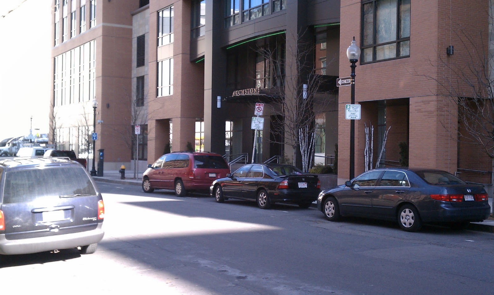
The Story: So, here we are on Causeway Street, at the top of the Bulfinch Triangle, the area between the West End and the North End of Boston that once comprised the tidal Mill Pond and was filled in the early 19th century according to a plan developed by Charles Bulfinch. This new residential/retail building, developed by Trinity Financial (of Carruth and Washington-Beech fame, see Blog Post Nos. 2010-20 and 2009-10) and now owned and operated by Archstone-Smith, is the first of a series of mixed-use buildings that will fill in the gap just north of the Greenway and create a strong street wall on the south side of Causeway Street: Simpson Housing will be developing Parcel 1 (directly across Haverhill Street and appearing likely to start construction this spring/summer) and Trinity Financial (there they are again) has just recently been designated as the developer to move forward with a long-stalled project on Parcels 2A/2B (to the south of Parcel 1).

Once again this is a massive improvement from the old elevated Central Artery that was bulldozed through the heart of downtown in the 1950s and was finally submerged over the course of the last decade through the Central Artery/Third Tunnel (widely dubbed the Big Dig), not to mention the submerging of the old elevated portion of the Green Line that went on around the same time (more on that below). Avenir's retail has been relatively slow to fill up -- the CVS/Pharmacy shown in Photo 11 is the first of the ground floor retail spaces to be occupied almost 2 years after the building saw its first residential tenants -- but that has had more to do with the overall economy than the design of the building or its location. As the recovery takes hold in earnest and more residents arrive with the foregoing two buildings as well as the redevelopment of Lovejoy Wharf to the northeast, the ground floor space should eventually be occupied and active street frontages established. It will still take some time, but it will come.

Now, to return to the Green Line: This north-south corridor is essentially where the Green Line used to emerge from the downtown tunnel that starts west of Kenmore Square. After Haymarket Station, the trolley rose out of the ground heading north, turned sharply at Causeway Street, and then bent again around what is now the O'Neill Federal Buidling and crossed the Charles River near the Museum of Science. That same basic routing has been maintained, but it is now entirely underground until emerging just before Science Park Station. Avenir sits on top of the reconfigured North Station platforms of the Green and Orange lines that resulted. The result is a sun-strewn Causeway Street after nearly a century of living in the shadows of the elevated train structure and the Central Artery itself.

Of course, the other relatively recent makeover that occurred here was in the demolition of the old North Station/Boston Garden, which fronted directly on Causeway Street, and its replacement with what is now named the "TD Garden" (having been initially known as the Fleet Center), which sits behind a surface parking lot. Having been in the old Boston Garden myself a few times, I will attest that it was a cramped and highly idiosyncratic arena with many partial and fully blocked views because of its supporting columns. That said, if you had a seat with a good sight line, you had much more than that: you had a phenomenal, up-close-on-the-action view of the game. I mean, you were on top of the players and the action like no place else. The new building is decent, but the character of the old place was essentially irreplaceable. Now, if only that parking lot that sits between the new garden and Causeway Street could be filled in with an appropriate front door for the arena and the train station below...

Sketch of the Restored Urban Fabric:


Saturday, October 30, 2010

Blog Post No. 2010-20: The Carruth makes Ashmont Station feel more...

...like a place, not just space to get through

1
2
3

4
5
6

The location: 1908 Dorchester Avenue, Dorchester, MA at Ashmont Station (near Peabody Square) (MAP).

The photos: (1) The flat-iron view of the building, from the north, along Dorchester Avenue; (2) Closer-up view of the entrance, showing the coffee shop, outdoor seating, and a planter/fountain feature on the left; (3) Dorchester Avenue streetscape (wide sidewalk, substantial street trees); (4) A view back north from inside the relocated busway toward Peabody Square; (5) View across the busway to the "back side" of the building; and (6) the cornerstone.

Year of urban fabric restoration: 2008 (see cornerstone).

The Story: It is a sad, unmistakable fact that the second half of the 20th century in the United States was, from a pedestrian-oriented urban design perspective, one long, virtually uniform nightmare for our urban places. With a thorough-ness and focus that could only be called admirable but for its outcome, we designed practically every inch of our built environment with one and only one goal in mind: to make it easier to travel around by single-occupant motor vehicle. We widened our streets. We eliminated on-street parking. We bulldozed entire city blocks to make way for surface parking in urban cores. We rammed interstate highways -- roads designed for the uninterrupted movement of goods through rural open spaces at high speeds -- through our downtowns and neighborhoods. And, in one of the sadder ironies of all, we surrounded many of our existing and, to the extent we built any, new transit facilities with surface parking lots and beefed-up auto access whenever possible. The idea there being that nearly everyone would access our transit systems by getting into their cars, driving to the station, parking, and then boarding a train.

Over the last 2 decades or so, we have begun to reverse all of these trends in the field of transportation. And one of the most visible signs of that reversal has been the rise of "Transit-Oriented Development," which is essentially the idea that transit facilities represent substantial public investments that can promote walkability and compact, land-efficient development if we plan and zone the areas around stations to accommodate that development. In short: Don't surround new or existing train stations with surface parking -- surround them with buildings and, if you think you really need them, parking garages that fit into the desired pattern of development. With a great many of the new or expanded systems around the U.S., this is simply common sense. I'm thinking most obviously of the fantastic work done in Portland, OR, and Charlotte, NC, with the station area planning around their new light rail transit systems, but this kind of thinking has been in play for new systems and extensions all around the country. Advance planning to ensure TODs around new stations instead of parking lots is well underway for the Green Line extension from Lechmere through Somerville and for the proposed South Coast Rail Project to Fall River and New Bedford.

But in a region like Boston, with a mature transit system and strong existing patterns of development, we have a huge range of opportunities to go back and retrofit existing station areas that were inappropriately forced into serving the car. Prime existing examples include Woodland on the D Branch of the Green Line in Newton and Station Landing on the Orange Line in Medford. TODs on the drawing boards, but stalled by the economy, include the massive NorthPoint development in East Cambridge adjacent to Lechmere Station, Westwood Station adjacent to the Route 128 Station in Westwood, and Waterfront Square at Revere Beach, adjacent to Wonderland Station. [DISCLAIMER: Your RTUF correspondent represents the developer of the last named project in his day job.] The Carruth building, erected at Ashmont Station in Dorchester through a public-private partnership between Trinity Financial and the MBTA, is an example of doing TOD perfectly in an already well-urbanized setting. The new building forms the missing street wall on Dorchester Avenue at Ashmont Station, just to the south of Peabody Square. In a neighborhood as large and as racially, ethnically, and socio-economically mixed as Dorchester, Peabody Square is never going to turn into Wellesley Square, and that's more than OK. For the foreseeable future, it will remain a melting pot, and The Carruth represents another ingredient to go along with other newcomers like Ashmont Grill, identified on the google map along Talbot Avenue. With its mix of market-rate homeownership and affordable rental units (42 and 74, respectively) above 10,000 square feet of retail including a Wainwright Bank branch, a coffee shop (my personal favorite local chain - Flatblack), the office for the local main streets organization, and Tavola, a new Mediterranean cuisine restaurant, the project is a virtual microcosm of the surrounding neighborhood within itself. As usual with Trinity and Icon Architects (their designers), the details are right on. I am especially partial to the flatiron view of the building. As faithful RTUF Nation citizens know, I am a New Yorker and one of my favorite buildings is the Flatiron Building in Madison Square. I have always been particularly impressed at how the building carried the shape of its constrained site so high into the air. The Carruth achieves the same iconic status here. It seems destined to be a symbol of the area for years to come.

The RTUF Sketch: The Carruth artfully bridges the space between the Dorchester Avenue street frontage and Ashmont Station itself.


Monday, May 17, 2010

Blog Post No. 2010-9: Washington Beech is just the latest in a line...

1 2 3 4 5 6 7 8 9


...of HOPE VI redevelopments here in Boston


Location: 4560 Washington Street, Roslindale, MA (Boston Housing Authority's Washington-Beech project, currently undergoing redevelopment) (MAP)

Year of Urban Fabric Restoration
: 2010-2012

The Photos:
In order, taking a walk through the first phase of the redevelopment, from a new Beechland Street and along the backs of the attached town houses (Photos 1 and 2), up along a new Beechland Circle past the town houses and row houses toward Washington Street (Photos 3 and 4), looking down Washington Street toward downtown Boston with the large multi-family building on the right (Photo 5), then from across Washington Street back toward the site (Photo 6), an internal street and sidewalk area detail shot (Photo 7), and finishing with two photos from the intersection of Beechland Circle and Beechland Street looking up toward Beech Street (Photo 8) and toward Washington Street (Photo 9).

The Story: By now, the story of how the federal Department of Housing and Urban Development (HUD) has funded the redevelopment of hundreds of distressed public housing projects across the county is almost as well known as the distress of those properties to begin with. Almost, but not quite. I'm sure most can easily name one or two of the truly horrific public housing projects such as Cabrini-Green in Chicago that became poster children for everything that was wrong with urban America in the 1970s and 1980s. That list at one time included Columbia Point in Boston, which was one of the first public housing project redevelopments in the late 1980s.

HUD's HOPE VI program (the acronym stands for "Housing Opportunities for People Everywhere") emerged in the early 1990s as part of the department's response to the report of the National Commission on Severely Distressed Public Housing. The report put the capstone on 30 years of withering, across-the-board criticism of public housing projects in the U.S. as generally dead-end disasters designed, constructed, and under-maintained in a manner that ultimately maximized alienation and separation from the broader community through super-blocks, high-rise construction that offered a twist on the Corbusian "Tower in the Park," and a lack of "defensible space." Among that report's major recommendations was prioritizing the redevelopment of the most distressed public housing projects into mixed-income, mixed housing-type neighborhoods that would reconnect with their surrounding communities both socio-economically and physically.


The physical, urban design component of HOPE VI has always been viewed as integral to the program, reflecting the significant influence of the Congress for the New Urbanism on HUD policy under the Clinton Administration. That administration's first HUD secretary, Henry Cisneros, was hismelf a signatory to the Charter of the New Urbanism in 1996. The guidelines for the HOPE VI program sent strong signals that HUD was serious about the urban design elements of each redevelopment. By and large and even as the HOPE VI program was put on life support by the second Bush Administration, that has meant that HOPE VI redevelopments fit much better with their surrounding communities. In fact, it's often a bit difficult to tell that they are even publicly-assisted housing. In Boston, HOPE VI redevelopments have included Mission-Main in Jamaica Plain, Orchard Gardens in Roxbury, and Maverick Gardens in East Boston. These redevelopments share an important feature with Washington-Beech: they were all done by the Boston Housing Authority with the help of Trinity Financial, a local developer that has also completed HOPE VI projects in Connecticut (Quinnipiac Terrace) and Rhode Island (Newport Heights).


As can be seen from the photos and the images below, Washington Beech is a true HOPE VI redevelopment from an urban design standpoint. It has mixed unit types in a variety of building types -- apartment building, row house, and attached town-house -- that respect and contribute to the surrounding and internal street network. The street network provides for real streets with curbs and sidewalks, on-street parking, and other elements that reflect a serious commitment to the public realm. The redevelopment also provides a centrally-located and publicly-accessible park space in the playground and basketball court.


All of this is to be contrasted with what existed here for the prior 50+ years: bare utilitarian brick structures located in a pattern that suggested a military encampment far more than a residential community. No real attention was paid to the street and the buildings were all surrounded almost uniformly by asphalt. Photos 6, 7, and 9 provide some particular points of comparison between old and new. Among them, I think Photo 7's depiction of the new sidewalk, curbing, street lights against the essentially undifferentiated treatment of the street on the opposite side is most instructive. And to take it a step further, it should not be surprising to see a dumpster facing into the street between the two older buildings on the right. In the old pattern, there really was no front, back or side to any of the buildings. They simply floated in an asphalt pond that meant it didn't really matter where you put something like a dumpster. In the new design, each buidling and therefore each set of units has clearly defined front (on the street), side, and back sides, providing an understandable logic for the location of entrances, utilities, and services (such as trash and general household storage). To say that the redeveloped Washington Beech will fit into the surrounding neighborhood far better than its predecessor is merely to state the obvious.


As can also be seen in the photos, the first phase is nearly complete and RTUF understands a ribbon-cutting will be held at the site on Saturday, June 29 at 11 am. Subsequent phases will fill in the rest of the overall site plan over the next 2 years.

RTUF sketch of the restored urban fabric: No hand-sketches this time. Instead, a link to the City of Boston's Assessing Department database for the pre-redevelopment configuration here, and an image provided by Trinity Financial (with credit to Icon Architecture), of the redevelopment's overall site plan (with Washington Street located at the top of the plan).